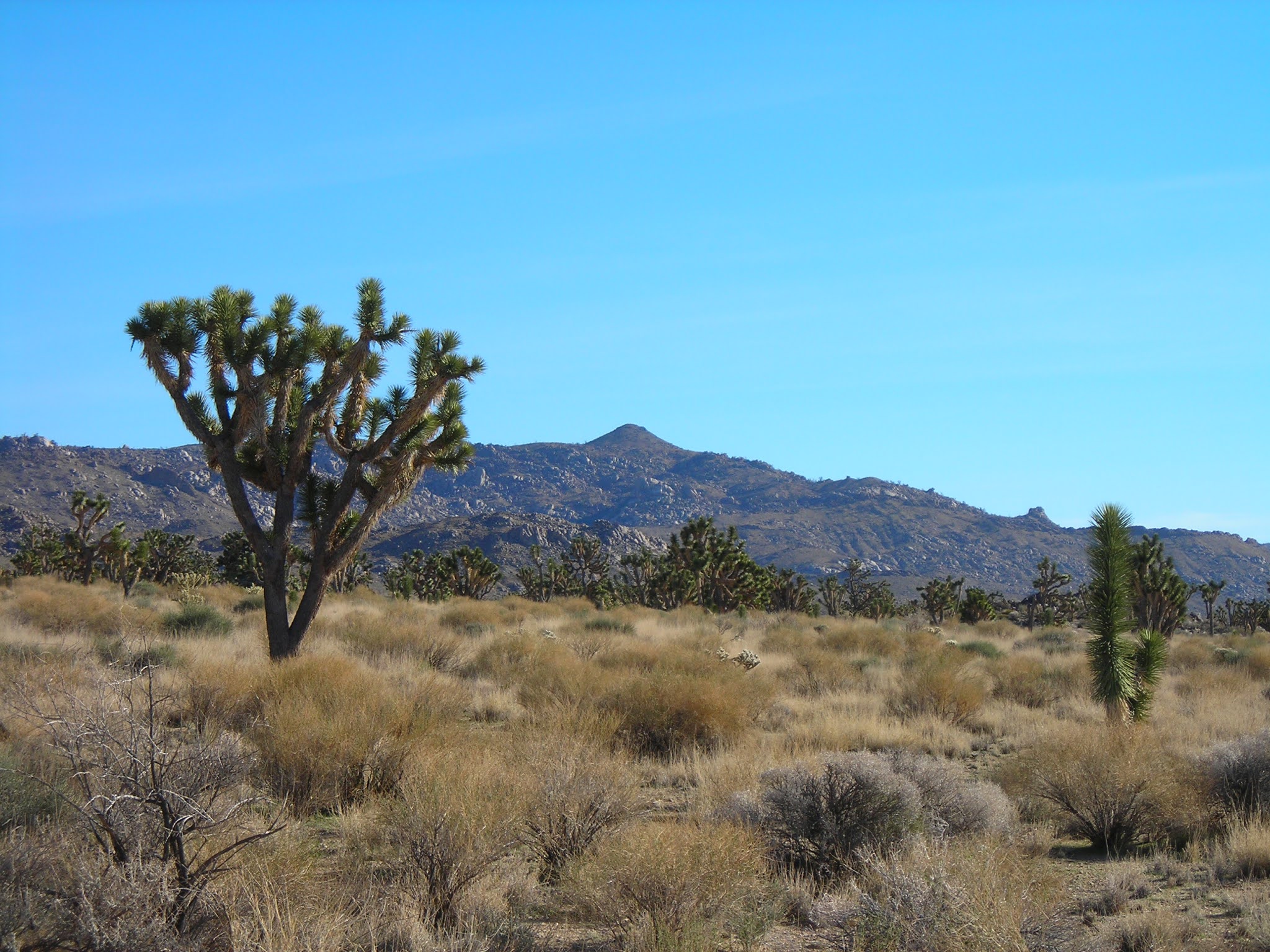
My initial idea was to drive to Death Valley with my son and hubby, stay until dark, see the night sky, and drive back home. Even if we had to drive back in the wee hours, who cared? We were on a winter break. No one had to be back at work until after Christmas. It seemed like the perfect opportunity to take advantage of the short winter days to get the maximum amount of night sky for my efforts.
At some point while I was pouring over maps, it occurred to me that this was a chance to drive to the Eureka Sand Dunes. These remote dunes had been on my wish list for years. Unlike the other nearby dunes in our region, like Kelso, Mesquite, Dumont, or Amargosa (those last two being ATV-friendly), the Eureka Dunes are relatively remote. The dunes are in the northern portion of Death Valley, in an area added to the park in 1994. Thanks to my son’s recent acquisition of a 4x4, we finally had two four-wheel drive vehicles for an expedition to the dunes, which had always been our preference for this outing.
The other immensely appealing aspect of this trip was the chance to get outside the range of cell phone service, to a place where GPS is unreliable and other humans are scarce. My research indicated the Eureka Sand Dunes were the place for all these things.
At his point, the hubby and son decided it would be a good idea to camp at the dunes. They pointed out how long it would take us to get there, given our proposed itinerary of Vegas – Beatty – Rhyolite – Titus Canyon – Eureka Dunes. We estimated eight hours travel time.
I was not a fan of the camping idea. My experiences with camping for a single day are that it’s a lot of work for one miserable, sleepless night. Also, we hadn’t camped in over ten years. They insisted it would be a good idea to stop for the night after a full day of driving over rough dirt roads, an idea I reluctantly agreed had some merit. Eventually, I decided if I had to give up sleep for a night to see the Eureka Sand Dunes and a spectacular night sky, it would be worth it.
Saturday, December 21, 0430
We wanted to make camp two hours before sunset, which we calculated to be roughly 1430 (2:30 p.m. for those of you who don’t do military time). The math on that worked out to a rendezvous time of 0430 to load the trucks for an 0600 departure on Saturday, December 21.
We’d gone back and forth on which day to leave because of the pesky cloud cover that had rudely arrived in the entire region. The weather reports indicated this sky-obscuring situation would only grow worse as the week of Christmas wore on. It was anybody’s guess as to whether or not we’d get to see the night sky, the inspiration for our adventure.
On Friday night we pulled together our ancient camping supplies and tried to sleep (mostly unsuccessfully) before our very early wake-up time.
Everyone was up early and we were on the road before our estimated departure time. By the time the sun was fully up, the buildings of Las Vegas were long behind us.
My son was driving his New Old Stock (it’s a thing, look it up), a Suzuki he’s been working on for months. This was its big road test. The hubby’s truck bed was filled with giant plastic storage tubs filled with our dated but still (surprisingly) functional gear, secured with tie-down straps so it kind of looked like we were moving. In back of the Suzuki, a tarp secured our six one-gallon water jugs, along with an assortment of tools deemed essential for this trip.
As we sped toward the tiny town of Beatty (pronounced BAY-dee, by the way, not BEE-tee, my non-native friends), I kept checking the forecast. It stubbornly remained cloudy. We all agreed that even if we didn’t get to see the Milky Way, seeing the dunes would be worth the trip.
I have a bit of mild obsession with the dune fields in the Mojave, a desert that doesn’t prominently feature dunes. Finding them takes some work. And the Eureka Dunes are booming dunes like the Kelso Dunes, a rare phenomenon occurring in only about 30 dunes world-wide. When enough of the sand moves, they “boom,” and a noise and vibration fills the air. You can feel it as well as hear it.
The Eureka Dunes stand about 680 feet (207 meters), putting them in the ranks of the tallest dunes in North America. Honors for the tallest dunes go to The Great Sand Dunes in southern Colorado, which rise over 750 feet.
Rhyolite and the Goldwell Open Air Museum
We fueled up in Beatty before heading to Rhyolite and the Goldwell Open Air Museum, our first stops before we hit Titus Canyon Road, the 25-mile, one-way dirt road that would take us into Death Valley. After that, we would head to the Eureka Sand Dunes.
Rhyolite and the Goldwell Open Air Museum are only 10 miles (16 kilometers) from Beatty, and we rolled in while the morning was still young.
A collection of art might be unconventional and unexpected in the middle of the desert, but it fits perfectly right outside Rhyolite, one of the best-known ghost towns in the region. It’s well worth the time to stop and walk the grounds, which are filled with thought-provoking and whimsical works of art... like a giant bedazzled cement sofa. Or a ghost getting ready to ride a bicycle, or a group of ghosts re-staging The Last Supper, or a giant naked cinder block lady. It’s all quite photo-worthy.
Rhyolite is a short distance down the road from Goldwell. Its slowly disintegrating buildings are visible from the museum grounds. I’ve written a lot about Rhyolite, a ghost town I’ve been exploring since long before protective fencing went up around many of its crumbling ruins. It’s a place I never get tired of visiting because I always find something new. You can drive through the town site, but I recommend getting out on foot to truly get a sense of this former boom town.
After wandering around the museum and Rhyolite, we headed to Titus Canyon.
Titus Canyon and Leadfield
The turn off to Titus Canyon Road comes up quickly after you leave Rhyolite. On the day we drove the road, it had recently re-opened after being closed due to storm damage, and was closed again about a week after our visit due to more storm damage.
If you intend to venture off into any dirt roads or remote areas of Death Valley, one of the things you need to do is check the park’s website for news about warnings and road closures. Storms in these parts can wash out roads, turn them into impassable mud, or cover them with ice and snow, or some combination of all of the above. Nature has the upper hand here.
Titus Canyon is in the Grapevine Mountains, and getting there involves driving through Titanothere Canyon. The landscape is full of otherworldly layers of colors and jagged, rocky mountains. Eventually the road reaches Red Pass at 5,250 feet, the high point between Titanothere and Titus Canyons, then descends to the bottom of the canyon where you’ll find the ghost town of Leadfield.
This road is a fun and popular drive. Four-wheel drive is nice to have, but we’ve done it with a two-wheel drive Jeep. I rode with my son on this stretch of road, which climbs and curves its way up and over Red Pass. We bounced all over the road, skittering sideways a little here and there as we went around the sharp corners. It’s one of those roads that’s so much fun you want to go back and do it again as soon as you’re done.
On this road we also discovered that our gallon water jugs were faring badly in the back of the Suzuki, now known as the Little Zook, although everyone was happy to find that the stuff leaking out of the back of Zook was water and not some essential car fluid. We patched up what we could and made a mental note about not bringing those again, in what was the first of many discoveries we mentally filed for future reference.
At Leadfield we stopped and explored the area, which has a few buildings, piles of mining tailings, and boarded-up mines. Throughout Death Valley – in fact, throughout Nevada, Arizona, Utah and Colorado – you’ll find plenty of abandoned mines (it’s actually a problem). If you ever find an old mine that’s still open, resist the urge to explore. They’re incredibly dangerous, being prone to cave-in and often have passages that open up unexpectedly beneath you. Mines are not worth the risk to explore. Go find a nice cave instead.
After leaving Leadfield, the road runs through a dry wash and, unsurprisingly, this area is prone to flash flooding. It looked like some serious water had been through not long before, judging from the deep channels, twisted plants, piles of gravel and unexpectedly placed debris in the sandy, rocky canyon floor. The cliffs around the road tower thousands of feet above you.
The last mile and half before you enter Death Valley is the most spectacular part of Titus Canyon because the cliff walls constrict to less than 20 feet across in some places. This slot canyon has no place to pull over. The twisty, turny road gives you no idea where you’re going until the very end, when you emerge dramatically into Death Valley to a panoramic view of the valley floor and surrounding mountain ranges.
Next stop: Eureka Sand Dunes.
The Eureka Sand Dunes
We drove north once we hit Scotty’s Castle Road. Scotty’s Castle itself and the road through Grapevine Canyon Road have been closed since massive floods damaged the area in 2015. Currently the NPS predicts the castle will re-open sometime in 2020, and I noticed the park’s website now has a link to a walking tour of the grounds.
Our route took us to Big Pine Road, a wash-boarded dirt road that stretched to the horizon, disappearing from our sight before we could ascertain its route up and over the Last Chance Mountains.
Off we started up road, which was teeth-chatteringly wash-boarded, featuring sections where water had carved dry stream beds across the road on its way to the valley on our left. Although we initially went with the theory that going faster on a wash board reduces the roughness of the road (an idea proven by Mythbusters, FYI), we soon found the downside: those rocky little ditches come up really quickly with that technique.
Crankshaft Crossing, with an appropriately ornamented sign, marked a fork in the road. We went left and climbed a winding road that took us over the mountains through Hanging Rock Canyon. We passed an abandoned mine and even hit a patch of paved road before finding South Eureka Valley Road.
The road to the dunes was just as wash-boarded as Big Pine Road, unsurprising given that Death Valley is known for its notoriously bumpy, rocky dirt roads.
In the distance, the sand dunes rose suddenly from the floor of a valley ringed with mountains, some snow-tipped. As we rounded the road toward the campground, we noticed something deeply distressing. People. Lots of people, by our measure. None of the cozy little spots with a picnic bench and metal fire ring were open, with the exception of one or two a few feet away from people who had already set up camp.
I had not driven eight hours to have strangers camping twenty feet away from me.
We had already decided that if the campground was full, we would find a spot off the road, so we continued on (away, I might add, from the outhouse, the only latrine in the area). Before our disgruntled exit from the campground area, we took a few moments to commiserate amongst ourselves about how very not-deserted this campground was, which was in sharp contrast to all the reports we’d read and watched. Apparently, we weren’t the only ones who had decided to squeeze in some camping during Christmas holiday.
We drove past the campground and noticed there were cleared areas on either side of the road obviously intended for camping, but an open area was all you got. We took one of these spots, which was out of sight of the campground. Two vehicles drove past and took spots some distance off, toward the point where the road curved around the dunes and turned from “high clearance suggested” to 4WD required. I was aghast that I could still see other people, although my hubby and son kept insisting our closest neighbor was at least a quarter mile away.
Wilderness markers all around reminded us to tread lightly. Recent rains had left a damp desert floor, evident in the cracked clay all around us. Our entire view to the south was of the magnificent Eureka Dunes. I took pictures while the tents went up, and then it was time to fix dinner and wait for the sun to go down and the stars to come out.
Right after sunset, a sliver of sky remained open above us although low-lying clouds obscured the majority of our view. We all watched this stretch of partially clear sky as it got darker and more stars appeared. A tiny section of the Milky Way peeked through, and even with the clouds, we could see more stars in that slice than in the whole night sky back in Vegas. On a clear night, I’m sure the night sky is utterly amazing here.
And then the clouds covered up the stars and we marveled at the darkness. We could still see the horizon, with the clouds giving off enough reflection for us to be able to make out the dunes. We all wondered if the light reflection was from Las Vegas and concluded it was possible. My son and I walked into the desert with our head lamps and contemplated climbing the dunes, but were worried we wouldn’t be able to navigate our way back to camp in the darkness.
Eventually, we ran out of things to do and climbed into our sleeping bags to try to go to sleep.
The cold had become bone-chilling at that point, far beyond what I had expected. I had a hat on and a blanket over my head, plus a sleeping bag and a couple of blankets over the rest of me, and any portion of skin that hit the air immediately felt like it was frozen. It didn’t take long to realize my original projection on the overnight temperature had been wildly wrong. I’d had a tough time finding a good weather prediction for the dunes. Most predictions for the park were for the southern regions like Furnace Creek, and they indicated about 38F for the overnight low. I had guessed we would be around freezing.
At about 0130, my hubby began trying to fill up his air mattress, unsuccessfully, in no small part because of the cold. He kept complaining about his air mattress deflating and not being able to feel his legs, a complaint that might otherwise worry a person except for the fact he has nerve damage and so consequently that isn’t an unusual condition for him. In this case, however, we could see our breath in the air, a situation that clearly wasn’t helping things.
Our son, to whom we had given all of our old (but good) backpacking gear, was sleeping away when we woke him with the mattress-filling-in-progress, which involved a lot of cursing (on the hubby’s part) and hysterical laughter (me).
We had the cheap tent and the worst gear, mostly because we can no longer fit into our two-person backpacking tent, and that’s before you consider the inflatable mattresses we now need to approximate anything close to sleep. And we don’t even want to talk about fitting into our old mummy bags. The phrase “ten pounds in a five pound sack” comes to mind. I was in mine, but it fit me so tightly I felt like a synthetic fabric sausage.
Fortunately, my hubby had insisted we bring essentially every blanket in the house, due to some traumatic incident he suffered as a young man which involved unexpected, unwanted spooning with another dude on a camping trip because of uncommonly cold weather. I wouldn’t go so far as to say all those blankets saved our lives, but I was sure glad we had them.
As it so happened, we had picked the winter solstice for our adventure, which meant we got to enjoy the intense cold for the longest night of the year. Had we been able to see the night sky, it would have been a jackpot for night sky viewing time.
Sunday, December 22, 0630
I got about two hours of sleep before the sun started to rise. Truthfully, I was so glad that the long night was over that I didn’t care about the sleeplessness. I was just looking forward to breaking camp and warming up inside the truck.
After the sun had risen behind a bank of low clouds, we waited a little bit before uncurling out of the nests we’d made. I wrapped myself in as many layers of clothing as I could get on and proceeded to the truck to check the temperature.
It was 28F.
The water we’d left out in a shallow rubber sink was frozen. Our pillows had become crunchy during the night. The inside of our tents had tiny ice crystals from our breath.
We were a combination of amused, horrified, and proud. We made some coffee and set about breaking camp as quickly as possible.
I may have said something along the lines of, “I told you so.”
My son and I had originally planned to climb the dunes before we left, but we took that off the table since we were not properly outfitted for the cold. Instead, we explored the base of the dunes and the campground, which emptied out fairly early in the day.
Our original plans for our trip back had included another dirt road near Stovepipe Wells, which was on the way home. We all agreed to skip that road, especially since after we left the dunes we had almost 50 miles of dirt before reaching a paved road.
When we reached the pavement, it felt silky smooth. We immediately gained a whole new appreciation for asphalt.
As we sped south through the valley to the cut-off to Beatty, the sky was a brilliant blue, a shade I’ve never seen outside of Death Valley. We soaked up the afternoon sun, enjoying the golden winter light and the dramatic desert around us.
The Zook had sustained a bit of damage: a broken sway bar mount and a busted heater core, but nothing that would keep us from making it back to town.
Then, just like that, we were back on US95 headed back home.
I was right: it had definitely been worth a sleepless night. And then some.